At some point during a long-distance hike one's admiration for nature and awestruck eyes become somewhat numb to almost everything. Not only is this an indication of how long one has been immersed in thick forest, it is also an indication of how many miles one does on an average day. The mere pronouncement of "five miles" normally doesn't draw much from the mind; we normally associate it with a five minute drive on the highway. Thru-hiking is done without cars though and there are only so many hours in the day to work with. A hiker that is in good shape can easily do twenty miles before five in the afternoon; and this will include a nice lunch break, ample time to turn one's head for views, and the ability to take a picture whenever the opportunity arises. Twenty-five miles, just five more miles, becomes a whole new beast. Unlike the quick drive that is forever ingrained in our minds when thinking about distance, five more miles for a hiker means two more hours. Finishing the day by seven in the evening doesn't sound so bad, but if the terrain gets the best of a thru-hiker's feet then seven quickly becomes eight. Then there's also thirty-mile days but I'll leave those for the time being to your own imagination.
In addition to the limited amount of time in any given day and the limited amount of a abuse one's feet can take each day on a thru-hike, there's the cruelty only a thick forest can produce. At times some amazing views will dart in front of one's eyes and these views offer periodic breaks from trail induced madness. A lack of regular views of something spectacular, or at least something different, often place one in a condition of watch-checking and mileage-counting. This can be a dangerous thing to think about too often and I try my best to force myself to think about something; anything that can break the monotony. A break usually ends with myself looking at where my next water source is at and then thinking to myself "hmmm... seven more miles, that's two and a half hours. I just need to think about six or seven different things." It becomes a time of self-reflection. I sometimes argue with myself, I find myself filled with regret from my past, disgust from wrongful actions I've taken, I think about what I've done with my life, I recall random acts of kindness, I think about friends that no longer walk this Earth, I think about where I might go to work on a masters degree, I think about how grateful I am that I'm not still dating this or that person, I try to calculate the cheapest way to keep my truck running for another year or two when I'm done with this hike, sometimes I just flat out work out long division that relates to miles to water or to a known point every few minutes--I'm 1/36th of the way there, I just have to do this 35 more times... I'm 1/18th of the way there... and so on and so forth.
This awkwardly essential task of keeping one's mind busy isn't always necessary though. After leaving Dunsmuir, the forest thinned out somewhat and a distant Shasta returned into view--still generously coated with snow in mid-July. In this same area is Castle Craggs, a mountain range that looks like a fortress where giants from an H.P. Lovecraft novel must have made theirselves at home and tossed large boulders down upon their enemies. These giants are long gone, but their boulders are still scatted along the trail and their fortress still stands and rarely fails to impress my eyes. This area is also riddled with numerous lakes, each perfect whenever one is both willing and able to hike off-trail for half a mile to a mile at the end of the day. When I went through I had no reservations descending down for a mile and several hundred feet down to enjoy Upper Seven, Bull, Big Marshy, and Statue Lakes. These lakes are full of all sorts of fish that absolutely love jumping out of the water to eat unsuspecting mosquitoes. These fish and I got along splendidly whenever I settled down to camp near their homes. Statue Lake, like the other three, is also off trail, and well worth the visit. It rests just behind Statue Mountain, home to a famous naturally occurring statue that resembles a short and corpulent little Batman. The statue (along with it's less interesting friends) is quite a treat when one can view it from its front and rear in the same day.
After finishing this wilderness area I hitched into Etna--the friendliest town thus far on the Pacific Crest Trail. The farther south in California one is, the more awkward and uncomfortable hitch-hiking can be. People will find any excuse to look away; they often will stare with expressions of disgust; they may accelerate when passing one by; and sometimes they may just flat out gaze at you with raised shoulders, flailing arms, and an unusual expression of rage. Do this long enough and eventually a kind soul will offer one a ride. Going into Etna, this little ritual was not necessary. I was passed by three cars going the opposite direction on a rarely traveled road, each car's occupants smiled and waved. When a car did drive my way, I was instantly picked up, and my brain picked by a cheerful mother, son, and several curious dogs (their poor little noses must have been in overdrive mode). In Etna I took the remainder of a short-mileage day off and enjoyed each and every one of my little trips. It didn't matter where I was--at the hostel, the brewery, the grocery store, one of Etna's delicious dinners--each and every person I met was extremely friendly. Most people who come across PCT thru-hikers mistake us for homeless degenerates or just poor fellows down on their luck. The residents of Enta know who we are and absolutely love us. It felt great. When I needed to hitch out of the town I thought my hitch wasn't going to happen anytime soon--Reststop, Dude, Viper, Not a Chance, and the Croatian Sensation all were hitching when I was. Instead of our mass becoming an impossible hitch it become one of the most suspiring. City employees drove by us in a work truck and said they'd come back with a van. All of us got a ride in a matter of minutes via the City of Etna's Police Activities League van. It's almost like I wasn't in California any more and in some state called Jefferson.
It's amazing what even a short stop in a friendly town can do. Etna was refreshing and the remainer of California felt like it went by entirely too fast--Razor Ridge, Fisher Lake, Marten Lake, Marble Valley and Mountain Grider Creek, and Seiad Valley. The trail alternated between quick climbs and quick descents, between dry and cool, between rocky exposed sections and pine needle-laden trail below shady canopy. What a relief, especially Marble Mountain, with its rich mixture of red volcanic colors and green ferns, it felt like Christmas in July. The thought of being so close to Seiad Valley was another morale booster as well. This little town is much more proud of its Jefferson State heritage than Etna. In Etna I didn't realize I was there until I read it on my bottle of beer. In Seiad it is posted on CalTrans signs, on the Post Office, on the trash truck, on the local diner, and in all other sorts of seemingly random places. It's technically part of California, but its unique disposition always makes it exciting to visit. My stomach was eternally grateful for the opportunity to swallow copious amounts of food at the local diner as well.
The final few miles of California went by quickly. It's almost 1700 miles from the California-Mexico border to the California-Oregon border. The mileage alone is in itself quite an accomplishment. It's also a very meaningful milestone because the most difficult and largest section is over. We only have two states remaining and they are going to feel like cake compared to California--they're smaller, they're cooler, and at this point I couldn't be in better physical shape than I am now. Arriving at the border was a sweet moment and one in which I had no qualms carrying a little extra liquid weight from Seiad Valley to, so I could celebrate with friends. Oregon already feels much cooler and the elevation profile for this state is exciting my knees, they should be getting a nice 457-mile break from endless climbing and descending.
One state down, two to go. Time to conquer Oregon.
Saturday, July 28, 2012
Thursday, July 26, 2012
Belden to Dunsmuir
Ah yes, Northern California, the shortest of the three main sections of California, but contrary to popular thru-hiker belief, not nearly as flat as expected. The climb out of Belden is burnt, dry, and exposed, and will bake you like a casserole in the afternoon heat. This is why it's best hiked after copious amounts of Ice cream and cold drinks from Belden town resort, where I stayed until 7pm the day Straps got off trail and I continued on.
Hiking out of Belden, it's a short 40 miles to Chester where I got off trail to resupply from the grocery store there. Each time I walk into a store nowadays, the stares from the other customers get increasingly hilarious, at least from my perspective. What isn't funny is having to figure out what I want to eat for four days while immersed in a sea of food, most of which I can't buy because it's too heavy. Sure, I'd love to eat a broiler chicken with a side of grilled veggies tomorrow night, but unless they find some way to dehydrate that into something less resembling artificially flavored cardboard, it's just not in the cards. Oh well. Ramen? Check. Instant mashed potatoes? Check. Whole package of Oreos that'll be good for, oh, two days? Double check.
From Chester it was only one day to Drakesbad resort where the owners kindly let hikers use the laundry and showers, as well as giving us discounted meals from the restaurant there. At this point, the trail is going right through Lassen national park. What's in this park? Oh, not much, only boiling lakes and steam-spewing geysers! Awesome. Super awesome. Out of Drakesbad smelling a little better, it was only hours before I once again was soaked in sweat from the repeating climbs and treeless stretches. Although, it was only 20 miles and the town of Old Station appeared through the trees promising a shop with ice cream, cold soda, and snacks of all flav...WHAT?! The store is closed? Queue Episode 3 Darth Vader when he learns of Padmé's death: NNNNOOOOOOOOO!!! At that point, Occupy Old Station store patio was in full effect in protest of this absurd unavailability of ice cream. There were about 10 hikers who all were hoping for the same thing, so everyone sat there, cooking their food, me included, as discussion about what we could have been eating slowly evolved into how far a walk it was to the other store. 2 miles? Well that's just absurd, who would want to walk that far anyway?

Onto the next section which included Hat Creek Rim, a ridge walk around a lava field and 30 miles of waterless, thin forest. Alright! I needed a new challenge. But myself and those I was hiking with were rewarded for our efforts two days later with ice cream and cheap camping at Burney State Park. Over the next few days, the trail meandered through densely forested areas where logging was still very popular and signs everywhere warned hikers of heavy equipment operating nearby. I made eye contact with a rather large black bear st one point and was glad when he opted to run for his life versus me, afterall it's hard to run with a pack on anyway. The rest of the walk into Dunsmuir was fairly uneventful, save for another bear sighting, this time a cub and its mother. I stayed back a ways upon spotting them, as one of the few things I know about bears is that they will do drastic things to protect their young, and I didn't want to be a part of one of those drastic things.


Stay tuned for Dunsmuir to Ashland. That's Ashland, Oregon. Oh yeah, California is quickly becoming yesterday's news. Now, Where can a guy get some ice cream around here?!
-Copernicus
Update: Oddball just crossed the border into Oregon, Copernicus is leaving Etna today and will cross the border on August 31.
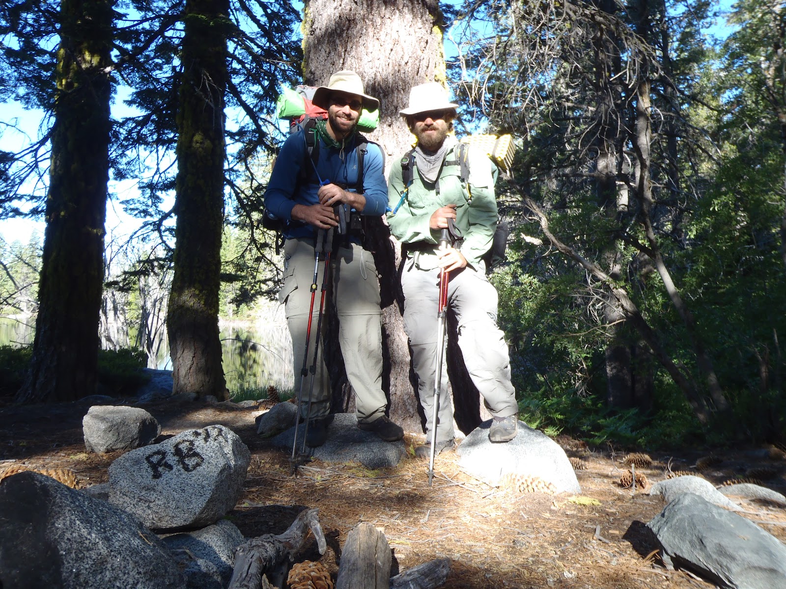
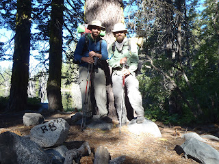
Straps and Copernicus

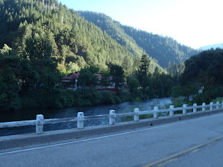
Looking back across the Feather River at Belden Town
Hiking out of Belden, it's a short 40 miles to Chester where I got off trail to resupply from the grocery store there. Each time I walk into a store nowadays, the stares from the other customers get increasingly hilarious, at least from my perspective. What isn't funny is having to figure out what I want to eat for four days while immersed in a sea of food, most of which I can't buy because it's too heavy. Sure, I'd love to eat a broiler chicken with a side of grilled veggies tomorrow night, but unless they find some way to dehydrate that into something less resembling artificially flavored cardboard, it's just not in the cards. Oh well. Ramen? Check. Instant mashed potatoes? Check. Whole package of Oreos that'll be good for, oh, two days? Double check.

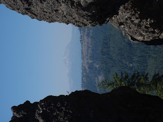
Mount Lassen (sideways)
From Chester it was only one day to Drakesbad resort where the owners kindly let hikers use the laundry and showers, as well as giving us discounted meals from the restaurant there. At this point, the trail is going right through Lassen national park. What's in this park? Oh, not much, only boiling lakes and steam-spewing geysers! Awesome. Super awesome. Out of Drakesbad smelling a little better, it was only hours before I once again was soaked in sweat from the repeating climbs and treeless stretches. Although, it was only 20 miles and the town of Old Station appeared through the trees promising a shop with ice cream, cold soda, and snacks of all flav...WHAT?! The store is closed? Queue Episode 3 Darth Vader when he learns of Padmé's death: NNNNOOOOOOOOO!!! At that point, Occupy Old Station store patio was in full effect in protest of this absurd unavailability of ice cream. There were about 10 hikers who all were hoping for the same thing, so everyone sat there, cooking their food, me included, as discussion about what we could have been eating slowly evolved into how far a walk it was to the other store. 2 miles? Well that's just absurd, who would want to walk that far anyway?

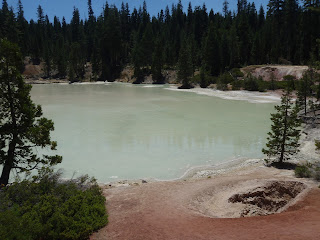
Terminal Geyser in Lassen State Park

Boiling Lake (literally, you can see it boiling in the middle)

Looking northward at Hat Creek Rim (trail is on top of the plateau)
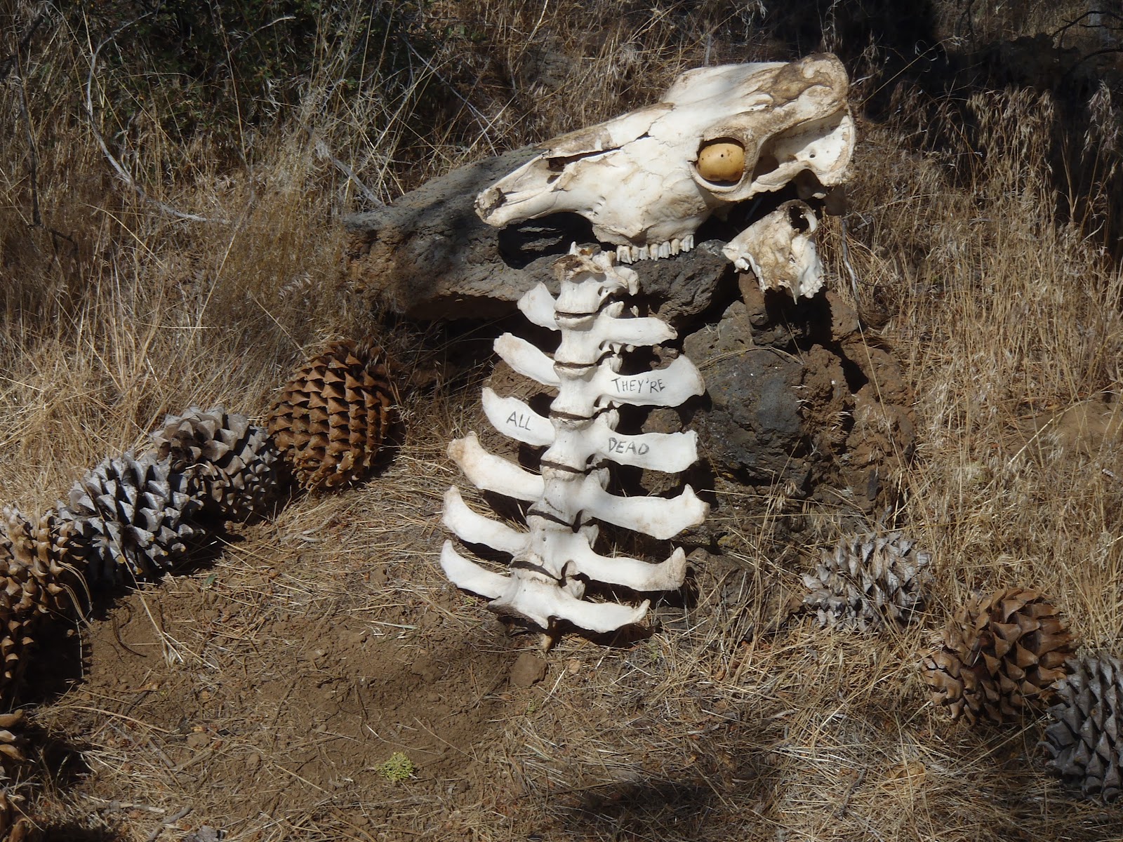
What happens if you don't carry enough water over the Hat Creek Rim
Stay tuned for Dunsmuir to Ashland. That's Ashland, Oregon. Oh yeah, California is quickly becoming yesterday's news. Now, Where can a guy get some ice cream around here?!
-Copernicus
Update: Oddball just crossed the border into Oregon, Copernicus is leaving Etna today and will cross the border on August 31.
Thursday, July 5, 2012
Finally, an Update!
Greetings from the PCT!
I know it's been quite a while since posting anything new, however, I have little to no excuse as to why. All I can say is that our latest town stops/resupply stops haven't been very conducive to writing 10 page trail sagas. Therefore, in an effort to keep this blog alive and functioning, the posts from here on out may be slightly shorter and summarized. Also, there will be a succession of past-dated entries appearing soon that will cover the last 500 miles. So, if you're still following us, be prepared to do a bit of reading!

Now it's time for a brief back story. After Oddball and I climbed over Duck Pass down to Mammoth Lakes for a resupply, I took the next few days to rent a car and drive down to Santa Barbara for my girlfriend Erin's graduation ceremony. It was a big surprise for her, and the entire weekend was fantastic. I didn't spend too much time thinking about the trail, but there were instances where I felt a bit strange knowing I was in the middle of hiking through the Sierras and would be back to hiking when the weekend was over. This little hiatus also meant that I'd be spending the next week trying to catch up with Oddball, as well as make it to South Lake Tahoe on time to meet up with my Erin, my brother Ryan and his girlfriend Calisa. The plan was for my brother Ryan to join me on the trail from Echo Pass (mile 1092.9) to Belden (mile 1289.3). Once at South Lake Tahoe, the four of us camped at beautiful Fallen Leaf Lake in South shore as I recovered from my six day sprint from Tuolumne (details coming). Ryan (now know as Straps) and I set off on June 28th from Echo Pass on Highway 50 (to the sound of highland bagpipes, courtesy of my good friend and piper Sean Cummings), and headed into Desolation Wilderness. We spent the next three and a half days traversing high ridges with grand views of Desolation, racing through mosquito-filled valleys and walked onto Highway 40 at Donner pass on July 1st.

Throughout this section one can see the powerful erosive effects of glacial movements as well as evidence of some volcanic activity, both of which contributed to the rugged beauty of the area millions of years ago. There were many, many small, winged vampires that constantly chased us around from Desolation to Granite Chief, however we escaped with only a few thousand bites each. Once at Donner Pass, a good family friend offered to put us up while we rested, did town chores, and I attempted to locate a misplaced resupply package. The package was found, the zero day was well worth it, and we were back on the trail on July 3rd to start the section to Sierra City. I can't say I'm not enjoying the slower pace as Straps builds up his trail legs; he is putting in more miles than I did my first week, go Straps!
So that brings us up to date. Straps is getting off trail at Belden and headed back to the "real world." He was a wise man and decided to keep his job! Oddball is about 2 days ahead of me, but I imagine I'll catch up before we complete California. Afterall, finally completing this state is an accomplishment worth sharing!
Like I stated previously, I will be posting entries later that cover the sections between Kennedy Meadows and South Lake Tahoe. The ongoing efforts by myself and Oddball to raise money for the Wounded Warrior Project have proven successful, as we broke the $1000 mark last month! We are still looking for donations in hopes to raise another $1000 this month. Remember, every donation is tax-deductible, so please consider contributing to this group, as they provide a valuable service to returning veterans.
Lastly, I hope everyone had a safe and fun Independence Day! Straps and I were treated to a barbecue dinner at a campground near Jackson Meadows Reservoir. The kindness of strangers continues to amaze me and I keep looking forward to meeting new people along the trail because of it.
-Copernicus.
I know it's been quite a while since posting anything new, however, I have little to no excuse as to why. All I can say is that our latest town stops/resupply stops haven't been very conducive to writing 10 page trail sagas. Therefore, in an effort to keep this blog alive and functioning, the posts from here on out may be slightly shorter and summarized. Also, there will be a succession of past-dated entries appearing soon that will cover the last 500 miles. So, if you're still following us, be prepared to do a bit of reading!

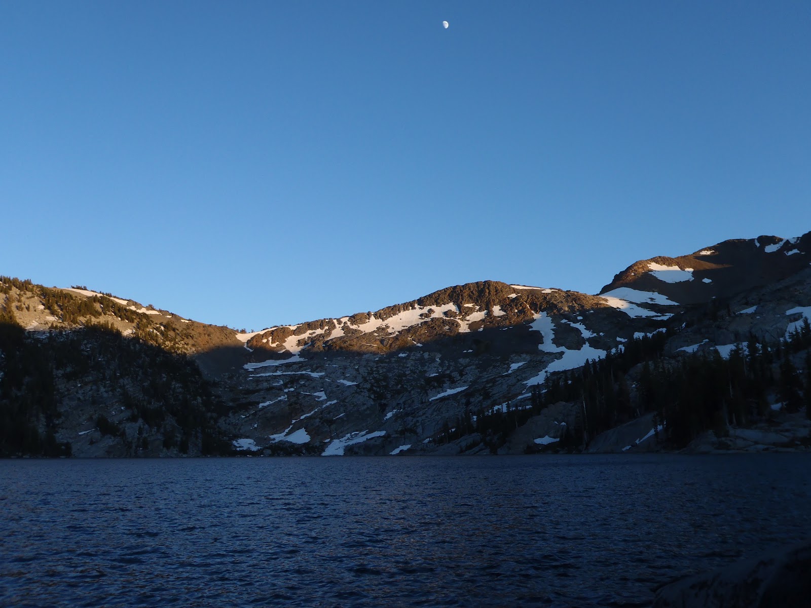
Lake Aloha: a little slanted.
Now it's time for a brief back story. After Oddball and I climbed over Duck Pass down to Mammoth Lakes for a resupply, I took the next few days to rent a car and drive down to Santa Barbara for my girlfriend Erin's graduation ceremony. It was a big surprise for her, and the entire weekend was fantastic. I didn't spend too much time thinking about the trail, but there were instances where I felt a bit strange knowing I was in the middle of hiking through the Sierras and would be back to hiking when the weekend was over. This little hiatus also meant that I'd be spending the next week trying to catch up with Oddball, as well as make it to South Lake Tahoe on time to meet up with my Erin, my brother Ryan and his girlfriend Calisa. The plan was for my brother Ryan to join me on the trail from Echo Pass (mile 1092.9) to Belden (mile 1289.3). Once at South Lake Tahoe, the four of us camped at beautiful Fallen Leaf Lake in South shore as I recovered from my six day sprint from Tuolumne (details coming). Ryan (now know as Straps) and I set off on June 28th from Echo Pass on Highway 50 (to the sound of highland bagpipes, courtesy of my good friend and piper Sean Cummings), and headed into Desolation Wilderness. We spent the next three and a half days traversing high ridges with grand views of Desolation, racing through mosquito-filled valleys and walked onto Highway 40 at Donner pass on July 1st.
Throughout this section one can see the powerful erosive effects of glacial movements as well as evidence of some volcanic activity, both of which contributed to the rugged beauty of the area millions of years ago. There were many, many small, winged vampires that constantly chased us around from Desolation to Granite Chief, however we escaped with only a few thousand bites each. Once at Donner Pass, a good family friend offered to put us up while we rested, did town chores, and I attempted to locate a misplaced resupply package. The package was found, the zero day was well worth it, and we were back on the trail on July 3rd to start the section to Sierra City. I can't say I'm not enjoying the slower pace as Straps builds up his trail legs; he is putting in more miles than I did my first week, go Straps!
So that brings us up to date. Straps is getting off trail at Belden and headed back to the "real world." He was a wise man and decided to keep his job! Oddball is about 2 days ahead of me, but I imagine I'll catch up before we complete California. Afterall, finally completing this state is an accomplishment worth sharing!
Like I stated previously, I will be posting entries later that cover the sections between Kennedy Meadows and South Lake Tahoe. The ongoing efforts by myself and Oddball to raise money for the Wounded Warrior Project have proven successful, as we broke the $1000 mark last month! We are still looking for donations in hopes to raise another $1000 this month. Remember, every donation is tax-deductible, so please consider contributing to this group, as they provide a valuable service to returning veterans.
Lastly, I hope everyone had a safe and fun Independence Day! Straps and I were treated to a barbecue dinner at a campground near Jackson Meadows Reservoir. The kindness of strangers continues to amaze me and I keep looking forward to meeting new people along the trail because of it.
-Copernicus.
Subscribe to:
Posts (Atom)